


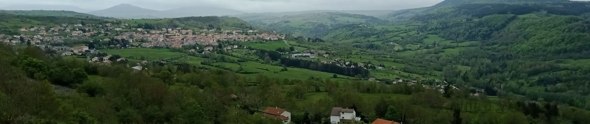
1 Stevenson Le Puy en Velay - Le Monastier sur Gazeille

VANDERPUTTENMi
User GUIDE
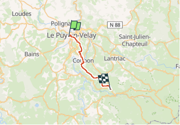

Length
22 km

Max alt
990 m

Uphill gradient
764 m
Km-Effort
31 km

Min alt
623 m

Downhill gradient
485 m
Boucle
No
Creation date :
2024-05-14 05:02:40.185
Updated on :
2024-05-28 19:16:38.71
5h21
Difficulty : Very difficult

FREE GPS app for hiking
 SityTrail
IGN / Geographical institutes
SityTrail Plus
The world is yours!
About
Trail Walking of 22 km to be discovered at Auvergne-Rhône-Alpes, Haute-Loire, Le Puy-en-Velay. This trail is proposed by VANDERPUTTENMi.
Photos


Positioning
Country:
France
Region :
Auvergne-Rhône-Alpes
Department/Province :
Haute-Loire
Municipality :
Le Puy-en-Velay
Location:
Unknown
Start:(Dec)
Start:(UTM)
569205 ; 4988048 (31T) N.
Comments